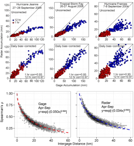
Modern remote-sensing technology including satellites and ground-based weather radar provide never-before-seen opportunities in hydrology because they can provide accurate and highly-detailed measurements of rainfall over large areas at relatively low cost. However, we need to understand how precise these measurements are before we can used them for scientific hydrology and for engineering decision-making.

For a short, well-produced and media-friendly intro to rainfall remote sensing, see WATER FALLS – A Science On a Sphere Movie about GPM (Global Precipitation Measurement).
For more information, you can contact me or check the following papers:
- Wright, D.B., J.A. Smith, G. Villarini, M.L. Baeck. “Hydroclimatology of flash flooding in Atlanta,” Water Resources Research, 48, W0524, 2012.
- Wright, D.B., J.A. Smith, G. Villarini, M.L. Baeck. “Long-term high-resolution radar rainfall fields for urban hydrology,” Journal of the American Water Resources Association, 50(3:713-734), 2014.